***********************************
Thanks to Charles Ashworth for allowing us to use his By-pass construction photos within the blog: Photo: thanks to Charles Ashworth By-Pass construction related Photo: thanks to Charles Ashworth By-Pass construction related Photo: thanks to Charles Ashworth By-Pass construction related Photo: thanks to Charles Ashworth By-Pass construction related Photo: thanks to Charles Ashworth By-Pass construction related Photo: thanks to Charles Ashworth By-Pass construction related Photo: thanks to Charles Ashworth By-Pass construction related Photo: thanks to Charles Ashworth By-Pass construction related Photo: thanks to Charles Ashworth By-Pass construction related Photo: thanks to Charles Ashworth By-Pass construction related Photo: thanks to Charles Ashworth By-Pass construction related Photo: thanks to Charles Ashworth By-Pass construction related Photo: thanks to Charles Ashworth By-Pass construction related Photo: thanks to Charles Ashworth By-Pass construction related Photo: thanks to Charles Ashworth By-Pass construction related Photo: thanks to Charles Ashworth By-Pass construction related Photo: thanks to Charles Ashworth ******************************************************************* More photos shown here: unknown photographer Here was the stretch that ran past St. James and St. Marys Football Grounds on approach to the "North Hag Tunnel" (Photographer: unknown) Here is a old photo taken from within North Hag Tunnel looking out and showing CWS Brittania Mill with first chimney and in the far background it looks like Clough End Mill (Hud Hey Road) Photographer: unknown Sadly the last photos showing the cutting through of North Hag, with Hutch Bank Quarry in the near background Photographer: unknown leading on to Park Avenue on the RH which is now a housing estate
This was land which used to belong to Sykeside Mill and boundary to Broadway,
nowadays it will be part of the Tesco Car Park, houses on the top are
Ventnor Road and Sykeside House lower down.
These are showing the rear of Fields Road Sykeside
This shows the area around the old Fields Road Mill and to the right the old Sykeside Mill
The area now partly covered with a new housing estate, and Tescos to the right hand side of the road.
Shows Woolpack (White building) with J and E Transport grey garage to the left hand side.
Making the roundabout at Road End
Road End traffic lights and before roundabout was built
This is the area close to the cattery and almost opposite Sykeside House
looking over towards the Woodpack, with the construction of the roundabout area
This photo is looking back from the Mayfield area towards Sykeside Mill (Now Tescos)
Shows the by-pass around 1981
whilst passing the old Sykeside Mill (now Tescos)
This is looking towards Rawtenstall and the swingback from the roundabout
close to the Woolpack
and Carter Place on the far right hand side, taken from Hud Hey Bridge
This is yet another photo from the roundabout area at Broadway
Dignatories and spectators at the opening ceremony below the roundabout at the Woolpack
Dignatories and spectators at the opening ceremony below the roundabout at the Woolpack
This shows in part the old railway track (Southbound), top Church etc
Another photo showing from Mayfield South to Sykeside
Another photo from Hud Hey towards Carter Place (right) and Rising Bridge.
*****************
Another photo from the opening day of the By-Pass
Photo: Rossendale Free Press
A fabulous before and after photo....
Above: Two lovely photos above kindly shared to us by Chris Kirby
They depict the (top photo) OLD (before the by-pass) and the (bottom photo) NEW (after the by-pass was built)
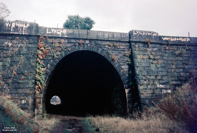
And here below we have some great photos of the NORTH HAG HILL (or Bonk) together with the North Hag Tunnel and showing the destruction of North Hag to make way for the new by-pass Photos: thanks to the late Arthur Kirby We are also fortunate to have some realtime footage showing some of the clearance for the Haslingden By Pass from the Joe Belshaw Collection. the motorway related content appears at the beginning with the removal of part of Victoria Park, but the main motorway construction is shown between 4:12 to 8:53 minutes into the film. |
Haslingden derives from Hazeldean or Valley of the Hazels. It lies 19 miles north of Manchester in the County of Lancashire. A area at one time noted in particular for its Stone, it also played a big part in the Woollen and then later Cotton Industries from the 18th and through the 19th and early to mid 20th Century... It is steeped in Local History and can also boast to have one of the most beautiful Natural Valleys around, where thousands come and visit annually


